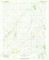
1970 Map of Flattop Hill
USGS Topo · Published 1973About this map
Flattop Hill and the surrounding high desert of Navajo County define this topographic study, reflecting the landscape as it was recorded in the late 1960s. The area is characterized by a network of seasonal watercourses and drainage systems, including Washboard Wash, Apache Wash, and East Wash, which carve through the arid terrain. Human activity in this portion of the Colorado Plateau is represented by isolated ranching and water infrastructure, such as Halfway Ranch and the Flattop Windmill. Notable landmarks like Monument Hill, Sheza Butte, and Buckhorn Hill provide distinct navigational points across a territory marked by numerous named draws, including Tenmile Draw and Ninemile Draw. A primitive Jeep Trail winds through the hills near Louis Hunt Tank, illustrating the limited transportation network used for land management and livestock operations in this remote segment of northeastern Arizona.
Find a feature on this map
15 named features on this map. Tap any name to fly to it.
Don’t see what you’re looking for? This feature index may not catch every label — zoom into the map to look around manually.
Map Details
Editions of this 1970 Flattop Hill Map
This is the sole edition of this map. No revisions or reprints were ever made.
Other maps of this area

1886 · Holbrook
USGS Topo · 1:250,000

1893 · Holbrook
USGS Topo · 1:250,000

1954 · Holbrook
USGS Topo · 1:250,000

1955 · St. Joseph 2 SE
USGS Topo · 1:24,000

1955 · St. Joseph 1 SE
USGS Topo · 1:24,000

1955 · Joseph City
USGS Topo · 1:62,500
1955 · Holbrook
USGS Topo · 1:62,500

1957 · Holbrook
USGS Topo · 1:250,000

1958 · Holbrook
USGS Topo · 1:250,000

1960 · Holbrook
USGS Topo · 1:250,000