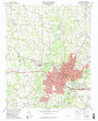
1983 Map of Shelby
USGS Topo · Published 1983About this map
Shelby anchors this 1980s landscape, positioned as a regional hub where the Southern Seaboard and Seaboard rail lines converge. The town's urban core is characterized by a dense network of civic and religious institutions, including Ryburn Mem Ch, Twelve Oaks Academy, and the Armory. To the west and north, the terrain transitions into a mosaic of small settlements like Metcalf, Kingston, and Shanghai, often defined by family-named landmarks and country churches such as Mulls Chapel and Ramseur Ch. The First Broad River and its tributaries, including Brushy Creek and Hickory Creek, carve through the rolling Piedmont topography, dictating the placement of early industry like the Sandpit and the Filtration Plant. This era shows the expansion of community infrastructure, from the Shelby Municipal Airport in the south to the Industrial Waste Ponds along the northern rail corridor.
Find a feature on this map
75 named features on this map. Tap any name to fly to it.
Don’t see what you’re looking for? This feature index may not catch every label — zoom into the map to look around manually.
Map Details
Editions of this 1983 Shelby Map
2 editions found
Other maps of this area

1906 · Kings Mountain
USGS Topo · 1:62,500

1908 · Kings Mountain
USGS Topo · 1:62,500

1909 · Gaffney
USGS Topo · 1:62,500

1909 · Lincolnton
USGS Topo · 1:62,500

1911 · Lincolnton
USGS Topo · 1:62,500

1950 · Shelby
USGS Topo · 1:62,500

1953 · Charlotte
USGS Topo · 1:250,000

1954 · Charlotte
USGS Topo · 1:250,000

1960 · Charlotte
USGS Topo · 1:250,000

1962 · Charlotte
USGS Topo · 1:250,000