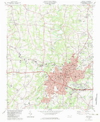
1983 Map of Shelby
USGS Topo · Published 1983About this map
Shelby dominates the landscape as the county seat in the early 1980s, where the convergence of the Southern and Seaboard railroads shaped the city's industrial and commercial core. The map documents the city's mid-century expansion with numerous community landmarks like Royster Memorial Park, Plaster Park, and the Shelby Municipal Airport to the south. Educational and social infrastructure is deeply mapped, featuring sites from Northside Sch to the Twelve Oaks Academy.
Find a feature on this map
64 named features on this map. Tap any name to fly to it.
Don’t see what you’re looking for? This feature index may not catch every label — zoom into the map to look around manually.
Map Details
Editions of this 1983 Shelby Map
2 editions found
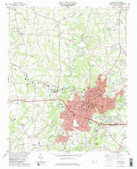
Other maps of this area

1906 · Kings Mountain
USGS Topo · 1:62,500

1908 · Kings Mountain
USGS Topo · 1:62,500

1909 · Gaffney
USGS Topo · 1:62,500

1909 · Lincolnton
USGS Topo · 1:62,500

1911 · Lincolnton
USGS Topo · 1:62,500

1950 · Shelby
USGS Topo · 1:62,500

1953 · Charlotte
USGS Topo · 1:250,000

1954 · Charlotte
USGS Topo · 1:250,000

1960 · Charlotte
USGS Topo · 1:250,000

1962 · Charlotte
USGS Topo · 1:250,000