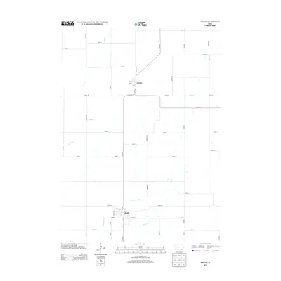
2013 Map of Shelby
USGS Topo · Published 2013About this map
The town of Shelby anchors this portion of southwest Iowa, situated where several local road networks converge. To the north, the small settlement of Tennant is laid out along a traditional grid with streets including 2nd St and 4th St. The agricultural landscape is defined by the winding paths of several waterways, most notably Silver Cr and Keg Cr. A distinctive local landmark, the Old Stone Arch Bridge, stands near the outskirts of Shelby, providing a concrete link to the region's engineering history. The map detail reflects the enduring rural structure of the county, characterized by a persistent section-line road system that connects these two primary communities via corridors like Co Hwy-M16 and Co Hwy-F66.
Find a feature on this map
49 named features on this map. Tap any name to fly to it.
Don’t see what you’re looking for? This feature index may not catch every label — zoom into the map to look around manually.
Map Details
Editions of this 2013 Shelby Map
This is the sole edition of this map. No revisions or reprints were ever made.
Other maps of this area

1954 · Omaha
USGS Topo · 1:250,000

1956 · Neola
USGS Topo · 1:24,000

1957 · Omaha
USGS Topo · 1:250,000

1958 · Omaha
USGS Topo · 1:250,000

1963 · Avoca NW
USGS Topo · 1:24,000

1963 · Avoca
USGS Topo · 1:24,000

1978 · Panama
USGS Topo · 1:24,000

1978 · Corley
USGS Topo · 1:24,000

1978 · Persia
USGS Topo · 1:24,000
1978 · Portsmouth
USGS Topo · 1:24,000