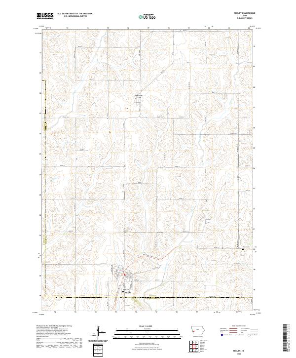
2022 Map of Shelby
USGS Topo · Published 2022About this map
Shelby and Tennant anchor this agricultural landscape in Western Iowa, situated at the intersection of several county lines including the border of Shelby and Pottawattamie counties. The town of Shelby is meticulously mapped, showing the grid of streets like Center St and Station St alongside the Shelby Cemetery. A notable historical landmark is the Rock Island Old Stone Arch Trail, which cuts across the terrain as a reminder of the region's railroad heritage.
Find a feature on this map
50 named features on this map. Tap any name to fly to it.
Don’t see what you’re looking for? This feature index may not catch every label — zoom into the map to look around manually.
Map Details
Editions of this 2022 Shelby Map
This is the sole edition of this map. No revisions or reprints were ever made.
Other maps of this area

1954 · Omaha
USGS Topo · 1:250,000

1956 · Neola
USGS Topo · 1:24,000

1957 · Omaha
USGS Topo · 1:250,000

1958 · Omaha
USGS Topo · 1:250,000

1963 · Avoca NW
USGS Topo · 1:24,000

1963 · Avoca
USGS Topo · 1:24,000

1978 · Panama
USGS Topo · 1:24,000

1978 · Corley
USGS Topo · 1:24,000

1978 · Persia
USGS Topo · 1:24,000
1978 · Portsmouth
USGS Topo · 1:24,000