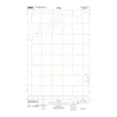
2011 Map of Sheldon NE
USGS Topo · Published 2011About this map
Leonard stands at the southeastern edge of this Cass County landscape, anchoring a rural grid of township roads that cross the North Dakota prairie. The Maple River meanders sharply through the northern portion of the quadrangle, its winding course providing a stark contrast to the rigid geometry of the surrounding section lines like 150th Ave SE and 48th St SE. For those researching local family history, the map identifies two significant burial sites: the Watson Cemetery situated near the riverbanks and the Leonard Cemetery located just north of the town site. Aviation and local infrastructure are represented by the Leonard Municipal Airport, while the extensive network of secondary roads, including 53rd St SE and 148th Ave SE, illustrates the organized agricultural settlement patterns typical of the region.
Find a feature on this map
24 named features on this map. Tap any name to fly to it.
Don’t see what you’re looking for? This feature index may not catch every label — zoom into the map to look around manually.
Map Details
Editions of this 2011 Sheldon NE Map
This is the sole edition of this map. No revisions or reprints were ever made.
Other maps of this area

1895 · Casselton
USGS Topo · 1:125,000

1897 · Casselton
USGS Topo · 1:125,000

1953 · Fargo
USGS Topo · 1:250,000

1956 · Fargo
USGS Topo · 1:250,000

1959 · Leonard
USGS Topo · 1:24,000

1960 · Power
USGS Topo · 1:24,000

1960 · Coburn
USGS Topo · 1:24,000
1960 · Sheldon
USGS Topo · 1:24,000

1961 · Durbin
USGS Topo · 1:24,000

1961 · Sheldon NW
USGS Topo · 1:24,000