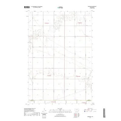
2017 Map of Sheldon NE
USGS Topo · Published 2017About this map
The Maple River meanders through the northern reaches of this rural landscape, carving a distinct valley through the agricultural grid of southeastern North Dakota. Located at the intersection of Cass Co, Ransom Co, and Richland Co, the terrain is defined by a dense network of section-line roads, including 46th St SE and 54th St SE. For those researching local families, the map identifies specific burial sites such as Watson Cem in the northwest and Leonard Cem further east. The layout of these townships, including t137n r52w and t138n r53w, reflects the enduring settlement patterns of the Red River Valley, where small cemeteries and river crossings remain the primary landmarks across the prairie.
Find a feature on this map
25 named features on this map. Tap any name to fly to it.
Don’t see what you’re looking for? This feature index may not catch every label — zoom into the map to look around manually.
Map Details
Editions of this 2017 Sheldon NE Map
This is the sole edition of this map. No revisions or reprints were ever made.
Other maps of this area

1895 · Casselton
USGS Topo · 1:125,000

1897 · Casselton
USGS Topo · 1:125,000

1953 · Fargo
USGS Topo · 1:250,000

1956 · Fargo
USGS Topo · 1:250,000

1959 · Leonard
USGS Topo · 1:24,000

1960 · Power
USGS Topo · 1:24,000

1960 · Coburn
USGS Topo · 1:24,000
1960 · Sheldon
USGS Topo · 1:24,000

1961 · Durbin
USGS Topo · 1:24,000

1961 · Sheldon NW
USGS Topo · 1:24,000