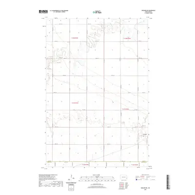
2020 Map of Sheldon NE
USGS Topo · Published 2020About this map
Leonard sits in the southeastern corner of this map, serving as the primary hub for the surrounding agricultural plains of Cass County. The landscape is defined by the winding course of the Maple River, which meanders through the northern sections, creating a distinct contrast to the rigid grid of section lines and gravel roads like Co Rd 16 and 46th St SE. Genealogists and local historians can locate the Watson Cem in the northwest and Leonard Cem just outside the town limits, providing clear markers for family research in this North Dakota prairie region. The boundary between Cass, Ransom, and Richland counties converges along the southern edge, illustrating how these administrative lines follow the township and range system through the fertile Red River Valley outskirts.
Find a feature on this map
25 named features on this map. Tap any name to fly to it.
Don’t see what you’re looking for? This feature index may not catch every label — zoom into the map to look around manually.
Map Details
Editions of this 2020 Sheldon NE Map
This is the sole edition of this map. No revisions or reprints were ever made.
Other maps of this area

1895 · Casselton
USGS Topo · 1:125,000

1897 · Casselton
USGS Topo · 1:125,000

1953 · Fargo
USGS Topo · 1:250,000

1956 · Fargo
USGS Topo · 1:250,000

1959 · Leonard
USGS Topo · 1:24,000

1960 · Power
USGS Topo · 1:24,000

1960 · Coburn
USGS Topo · 1:24,000
1960 · Sheldon
USGS Topo · 1:24,000

1961 · Durbin
USGS Topo · 1:24,000

1961 · Sheldon NW
USGS Topo · 1:24,000