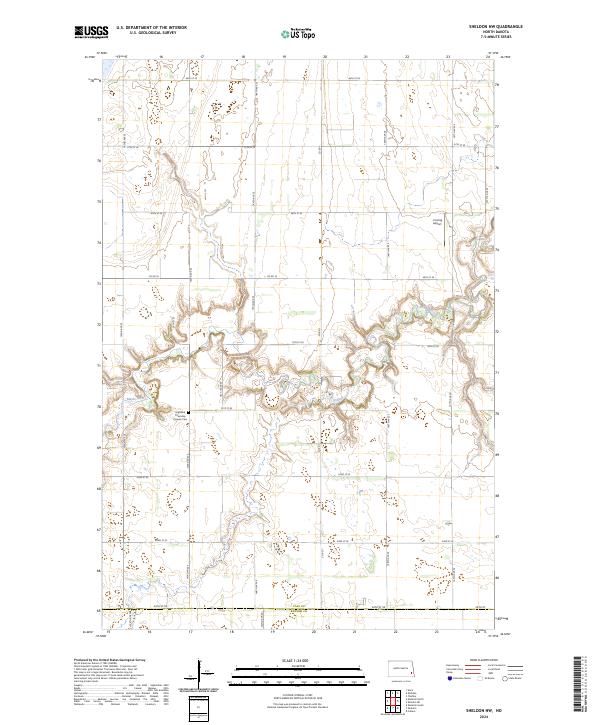
2024 Map of Sheldon NW
USGS Topo · Published 2024About this map
The winding course of the Maple River carves a distinct path through the flat agricultural landscape of southeastern North Dakota. This section of the river valley is characterized by complex meanders and erosion patterns that stand in sharp contrast to the rigid grid of section roads like 49th St SE and Co Rd 16. In the western portion of the map, the Highland Township Pioneer Cem remains a significant point of interest for genealogists tracing early families in the area. Land use in this region reflects a balance between aviation and conservation, evidenced by the private J Vining Airport and the expansive Cass County Waterfowl Production Area in the north. The southern boundary follows the Cass Co Ransom Co line, marking the transition between these two rural jurisdictions.
Find a feature on this map
21 named features on this map. Tap any name to fly to it.
Don’t see what you’re looking for? This feature index may not catch every label — zoom into the map to look around manually.
Map Details
Editions of this 2024 Sheldon NW Map
This is the sole edition of this map. No revisions or reprints were ever made.
Other maps of this area

1895 · Casselton
USGS Topo · 1:125,000

1897 · Tower
USGS Topo · 1:125,000

1897 · Casselton
USGS Topo · 1:125,000

1953 · Fargo
USGS Topo · 1:250,000

1956 · Fargo
USGS Topo · 1:250,000

1960 · Coburn
USGS Topo · 1:24,000

1960 · Enderlin South
USGS Topo · 1:24,000
1960 · Sheldon
USGS Topo · 1:24,000

1961 · Sheldon NW
USGS Topo · 1:24,000
1961 · Sheldon NE
USGS Topo · 1:24,000