
1961 Map of Sheldon NW
USGS Topo · Published 1963About this map
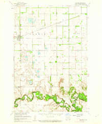
The Maple River carves a deeply incised, meandering path across this Red River Valley landscape, creating a distinct band of topographic relief against the surrounding flat prairie. Surveyed in the early 1960s as part of the Missouri River Basin development program, the map reveals a highly structured agricultural grid spanning several townships including Eldridge, Walburg, and Highland. This era of rural North Dakota is characterized by dispersed farmsteads and essential community nodes, such as School No 83 and a localized Townhall. Small-scale aviation infrastructure like a Landing Strip and natural water features like the Flowing Well point to the practicalities of mid-century prairie life. The boundary between Cass and Ransom Counties serves as a primary geographic anchor for the region's southern tier, including the townships of Greene and Coburn.
Find a feature on this map
12 named features on this map. Tap any name to fly to it.
Don’t see what you’re looking for? This feature index may not catch every label — zoom into the map to look around manually.
Map Details
Editions of this 1961 Sheldon NW Map
This is the sole edition of this map. No revisions or reprints were ever made.
Other maps of this area

1895 · Casselton
USGS Topo · 1:125,000

1897 · Tower
USGS Topo · 1:125,000

1897 · Casselton
USGS Topo · 1:125,000

1953 · Fargo
USGS Topo · 1:250,000

1956 · Fargo
USGS Topo · 1:250,000

1960 · Coburn
USGS Topo · 1:24,000

1960 · Enderlin South
USGS Topo · 1:24,000
1960 · Sheldon
USGS Topo · 1:24,000
1961 · Sheldon NE
USGS Topo · 1:24,000

1961 · Enderlin North
USGS Topo · 1:24,000