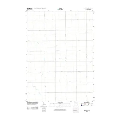
2010 Map of Sheldon SE
USGS Topo · Published 2010About this map
Philby sits at the heart of this Sioux County agricultural landscape, where the Jefferson-era section grid is meticulously etched into the terrain. The map reveals a highly structured environment where gravel roads like Monroe Ave and Nettle Ave follow the straight lines of the public land survey system, punctuated by farmsteads and rural intersections. This geometric order is broken only by the meandering paths of local waterways, including Willow Creek and Stofferan Creek. These streams create subtle corridors of natural variation across the prairie, while Roetzel Creek and Lamkin Creek further define the drainage patterns of this northwestern Iowa region. The map provides a clear picture of early 21st-century land use, where transport infrastructure such as 400th St and Olive Ave serves as the primary skeleton for the area's rural development and agricultural operations.
Find a feature on this map
20 named features on this map. Tap any name to fly to it.
Don’t see what you’re looking for? This feature index may not catch every label — zoom into the map to look around manually.
Map Details
Editions of this 2010 Sheldon SE Map
This is the sole edition of this map. No revisions or reprints were ever made.
Other maps of this area

1954 · Fairmont
USGS Topo · 1:250,000

1954 · Fort Dodge
USGS Topo · 1:250,000

1957 · Fort Dodge
USGS Topo · 1:250,000

1958 · Fort Dodge
USGS Topo · 1:250,000

1958 · Fairmont
USGS Topo · 1:250,000

1964 · Hospers
USGS Topo · 1:24,000

1964 · Matlock
USGS Topo · 1:24,000

1964 · Sheldon SE
USGS Topo · 1:24,000

1964 · Sheldon
USGS Topo · 1:24,000

1964 · Primghar
USGS Topo · 1:24,000