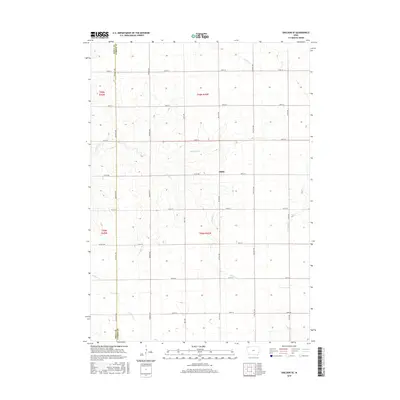
2015 Map of Sheldon SE
USGS Topo · Published 2015About this map
Philby stands as a quiet focal point in this agricultural landscape along the Sioux and O'Brien County line. The terrain is defined by the subtle drainage patterns of several prairie streams, including Willow Cr, Stofferan Cr, and Roetzel Cr, which carve gentle paths through the surrounding farmland. The rectilinear grid of rural roads, such as McKinley Ave and Nettle Ave, underscores the enduring influence of the Public Land Survey System on the Iowa countryside. This 2015 survey reveals a classic Midwestern township structure, where transport routes like Co Hwy B46 and Co Rd B40 facilitate movement between scattered farmsteads. The lack of dense urbanization highlights the area's continued dedication to large-scale agriculture, preserved here in the precise topographical detail typical of the U.S. Geological Survey.
Find a feature on this map
27 named features on this map. Tap any name to fly to it.
Don’t see what you’re looking for? This feature index may not catch every label — zoom into the map to look around manually.
Map Details
Editions of this 2015 Sheldon SE Map
This is the sole edition of this map. No revisions or reprints were ever made.
Other maps of this area

1954 · Fairmont
USGS Topo · 1:250,000

1954 · Fort Dodge
USGS Topo · 1:250,000

1957 · Fort Dodge
USGS Topo · 1:250,000

1958 · Fort Dodge
USGS Topo · 1:250,000

1958 · Fairmont
USGS Topo · 1:250,000

1964 · Hospers
USGS Topo · 1:24,000

1964 · Matlock
USGS Topo · 1:24,000

1964 · Sheldon SE
USGS Topo · 1:24,000

1964 · Sheldon
USGS Topo · 1:24,000

1964 · Primghar
USGS Topo · 1:24,000