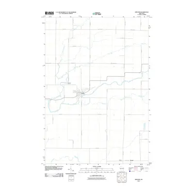
2010 Map of Sheldon
USGS Topo · Published 2010About this map
Sheldon serves as the primary hub of this northern Wisconsin landscape, situated at the confluence of several key waterways. The community is defined by its proximity to the Jump River, which winds through the center of the sheet, and the Little Jump River, which enters from the northwest. A grid of rural routes, including County Hwy VV and Pioneer Rd, connects the village to outlying homesteads and agricultural lands.
Find a feature on this map
37 named features on this map. Tap any name to fly to it.
Don’t see what you’re looking for? This feature index may not catch every label — zoom into the map to look around manually.
Map Details
Editions of this 2010 Sheldon Map
This is the sole edition of this map. No revisions or reprints were ever made.
Other maps of this area

1947 · Sheldon
USGS Topo · 1:48,000

1948 · Ladysmith
USGS Topo · 1:48,000

1949 · Sheldon
USGS Topo · 1:48,000

1950 · Ladysmith
USGS Topo · 1:48,000

1951 · Cornell
USGS Topo · 1:62,500

1951 · Gilman
USGS Topo · 1:62,500

1953 · Rice Lake
USGS Topo · 1:250,000

1959 · Rice Lake
USGS Topo · 1:250,000
1971 · Ladysmith
USGS Topo · 1:24,000
1971 · Jump River
USGS Topo · 1:24,000