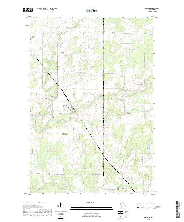
2022 Map of Sheldon
USGS Topo · Published 2022About this map
Sheldon sits at the convergence of several rural corridors where the Jump River and Little Jump River meet. This 2022 survey documents the village structure along Main St and Lacy St, reflecting a community deeply tied to the river systems of Rusk County. To the south, the smaller settlement of Donald is noted near the Fisher River, accompanied by the Donald Cem. The landscape is defined by its complex drainage, with Alder Cr and Shoulder Cr carving through the township lines of T33N and T32N. Historical infrastructure is visible in the naming of Railroad Way, hinting at the area's transit past, while Woodlawn Cem provides a primary point of interest for those researching local family lineages near the village of Sheldon.
Find a feature on this map
38 named features on this map. Tap any name to fly to it.
Don’t see what you’re looking for? This feature index may not catch every label — zoom into the map to look around manually.
Map Details
Editions of this 2022 Sheldon Map
This is the sole edition of this map. No revisions or reprints were ever made.
Other maps of this area

1947 · Sheldon
USGS Topo · 1:48,000

1948 · Ladysmith
USGS Topo · 1:48,000

1949 · Sheldon
USGS Topo · 1:48,000

1950 · Ladysmith
USGS Topo · 1:48,000

1951 · Cornell
USGS Topo · 1:62,500

1951 · Gilman
USGS Topo · 1:62,500

1953 · Rice Lake
USGS Topo · 1:250,000

1959 · Rice Lake
USGS Topo · 1:250,000
1971 · Ladysmith
USGS Topo · 1:24,000
1971 · Jump River
USGS Topo · 1:24,000