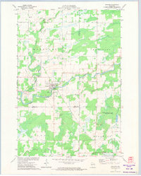
1971 Map of Sheldon
USGS Topo · Published 1974About this map
Sheldon serves as the central hub of this northern Wisconsin landscape, situated at the confluence of the Jump River and the Little Jump River. The village layout is clearly defined, featuring a local Fairground, a Gaging Station, and a park near the riverbank. This 1970s survey illustrates a region where timber and water remain central, as seen in the expansive Pershing State Wildlife Management Area and the meandering course of Shoulder Creek.
Find a feature on this map
27 named features on this map. Tap any name to fly to it.
Don’t see what you’re looking for? This feature index may not catch every label — zoom into the map to look around manually.
Map Details
Editions of this 1971 Sheldon Map
This is the sole edition of this map. No revisions or reprints were ever made.
Other maps of this area

1947 · Sheldon
USGS Topo · 1:48,000

1948 · Ladysmith
USGS Topo · 1:48,000

1949 · Sheldon
USGS Topo · 1:48,000

1950 · Ladysmith
USGS Topo · 1:48,000

1951 · Cornell
USGS Topo · 1:62,500

1951 · Gilman
USGS Topo · 1:62,500

1953 · Rice Lake
USGS Topo · 1:250,000

1959 · Rice Lake
USGS Topo · 1:250,000
1971 · Ladysmith
USGS Topo · 1:24,000
1971 · Jump River
USGS Topo · 1:24,000