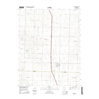
2015 Map of Sheldon
USGS Topo · Published 2015About this map
Sheldon anchors this portion of southwest Missouri, situated near the border of Vernon Co and Barton Co. The landscape is defined by a high concentration of burial grounds, providing a significant resource for genealogical research into local families. These include Bickett Cemetery, Rosewood Cemetery, Avola Cemetery, Davis Cemetery, Oak Grove Cemetery, and Sheldon Cemetery.
Find a feature on this map
68 named features on this map. Tap any name to fly to it.
Don’t see what you’re looking for? This feature index may not catch every label — zoom into the map to look around manually.
Map Details
Editions of this 2015 Sheldon Map
This is the sole edition of this map. No revisions or reprints were ever made.
Other maps of this area

1886 · Nevada
USGS Topo · 1:125,000

1894 · Nevada
USGS Topo · 1:125,000

1933 · Camp Clark
USGS Topo · 1:24,000

1939 · Dederick
USGS Topo · 1:24,000

1939 · Moundville
USGS Topo · 1:24,000
1942 · Dederick
USGS Topo · 1:24,000
1942 · Moundville
USGS Topo · 1:24,000

1947 · Joplin
USGS Topo · 1:250,000
1948 · Nevada
USGS Topo · 1:24,000

1949 · Joplin
USGS Topo · 1:250,000