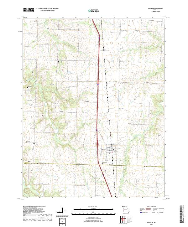
2021 Map of Sheldon
USGS Topo · Published 2021About this map
Sheldon serves as the central hub of this agricultural landscape in the 2020s, situated right at the boundary where Vernon Co and Barton County meet. The town's grid is clearly defined by streets such as W Main St and W Market St, while the modern corridor of Interstate 49 runs parallel to Old Hwy 71, illustrating the evolution of regional transit. For those researching local families, the area is dotted with several well-established burial grounds, including Sheldon Cem, Bickett Cem, and Rosewood Cem. The surrounding countryside is defined by a network of drainage systems, with Little Clear Cr and Landon Br winding through the fields. This survey captures the modern rural structure of the Missouri plains, where long-established farm roads like Union Track Rd and Veteran Rd continue to organize the landscape around the original townsite.
Find a feature on this map
43 named features on this map. Tap any name to fly to it.
Don’t see what you’re looking for? This feature index may not catch every label — zoom into the map to look around manually.
Map Details
Editions of this 2021 Sheldon Map
This is the sole edition of this map. No revisions or reprints were ever made.
Other maps of this area

1886 · Nevada
USGS Topo · 1:125,000

1894 · Nevada
USGS Topo · 1:125,000

1933 · Camp Clark
USGS Topo · 1:24,000

1939 · Dederick
USGS Topo · 1:24,000

1939 · Moundville
USGS Topo · 1:24,000
1942 · Dederick
USGS Topo · 1:24,000
1942 · Moundville
USGS Topo · 1:24,000

1947 · Joplin
USGS Topo · 1:250,000
1948 · Nevada
USGS Topo · 1:24,000

1949 · Joplin
USGS Topo · 1:250,000