
2023 Map of Sheldrake
USGS Topo · Published 2023About this map
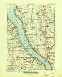
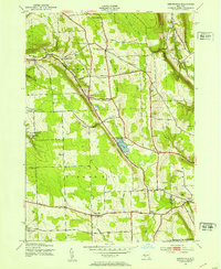
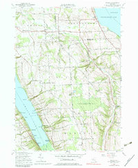
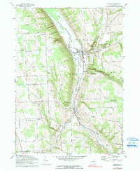
Wells College anchors the historic lakeshore at Aurora, a prominent settlement on the eastern banks of Cayuga Lake. This modern survey documents the intricate interface between the water and the Finger Lakes landscape, where steep ravines like Beard Gully and Carter Gully cut through the glacial till toward the shore. The map illustrates a pattern of long-established agricultural and residential life, connected by local routes like Honoco Rd and Co Rte 43A. Points of interest for local historians include the King Ferry Station area and numerous small burial grounds, such as the Mendenhall Farm Cem and Friends Cem, which speak to the area's Quaker heritage and early farmstead roots. Notable geographic features like Pumpkin Hill and Stony Point define the topography, while small airfields like Match Mate Airport serve the local community.
Find a feature on this map
94 named features on this map. Tap any name to fly to it.
Don’t see what you’re looking for? This feature index may not catch every label — zoom into the map to look around manually.
Map Details
Editions of this 2023 Sheldrake Map
This is the sole edition of this map. No revisions or reprints were ever made.
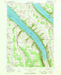
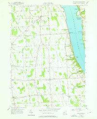
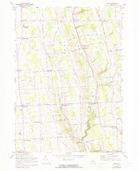
Historical Maps of Elm Beach Through Time
38 maps found

1898 Moravia
Cayuga County, NY
1902 Genoa
Cayuga County, NY
1902 Moravia
Cayuga County, NY

1942 Genoa
Cayuga County, NY

1942 Sheldrake
Cayuga County, NY

1943 Cato
Cayuga County, NY

1943 Genoa
Cayuga County, NY

1943 Montezuma
Cayuga County, NY
1943 Moravia
Cayuga County, NY
1943 Owasco
Cayuga County, NY

1943 Scipio
Cayuga County, NY
1943 Sempronius
Cayuga County, NY

1943 Sheldrake
Cayuga County, NY

1943 Spafford
Cayuga County, NY

1943 West Ninemile Point
Cayuga County, NY

1949 Moravia
Cayuga County, NY
1954 Cato
Cayuga County, NY
1954 Montezuma
Cayuga County, NY

1954 Victory
Cayuga County, NY
1954 West Ninemile Point
Cayuga County, NY
1955 Owasco
Cayuga County, NY
1955 Spafford
Cayuga County, NY
1956 Scipio Center
Cayuga County, NY
1970 Genoa
Cayuga County, NY
1971 Moravia
Cayuga County, NY

1971 Sempronius
Cayuga County, NY
1971 Sheldrake
Cayuga County, NY

2023 Cato
Cayuga County, NY

2023 Genoa
Cayuga County, NY

2023 Montezuma
Cayuga County, NY

2023 Moravia
Cayuga County, NY

2023 Owasco
Cayuga County, NY

2023 Scipio Center
Cayuga County, NY

2023 Sempronius
Cayuga County, NY
2023 Sheldrake
Cayuga County, NY

2023 Spafford
Cayuga County, NY

2023 Victory
Cayuga County, NY
2023 West Ninemile Point
Cayuga County, NY