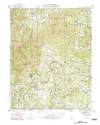
1950 Map of Shell Knob
USGS Topo · Published 1983About this map
The James River and Flat Creek converge in the rugged Missouri hills, carving deep bends through the terrain of Shell Knob and Alpine long before modern lake development changed the valley floors. This 1950 revision, based on surveys by F.W. Hughes and W.S. Gehres, captures an era of rural density where small schoolhouses and fords defined local geography. Notable landmarks like the Schreiner Ferry across the White River and the Woolly Creek Ford illustrate a reliance on river-level crossings for travel between settlements such as Cape Fair and Viola. Genealogists will find a high concentration of community anchors, including Liberty Church and nearly a dozen rural schools like Cedar Mound, Pineview, and Victory. The map also identifies natural landmarks including the Natural Bridge and the distinct elevation of Pilot Knob.
Find a feature on this map
78 named features on this map. Tap any name to fly to it.
Don’t see what you’re looking for? This feature index may not catch every label — zoom into the map to look around manually.
Map Details
Editions of this 1950 Shell Knob Map
3 editions found

Other maps of this area

1900 · Eureka Springs
USGS Topo · 1:125,000

1901 · Eureka Springs
USGS Topo · 1:125,000

1904 · Harrison
USGS Topo · 1:125,000

1905 · Harrison
USGS Topo · 1:125,000

1907 · Forsyth
USGS Topo · 1:125,000

1927 · Shell Knob
USGS Topo · 1:62,500

1937 · Cassville
USGS Topo · 1:48,000

1942 · Aurora
USGS Topo · 1:62,500

1943 · Monett
USGS Topo · 1:62,500

1944 · Cassville
USGS Topo · 1:62,500