
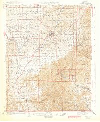
1944 Map of Cassville
USGS Topo · Published 1944About this map
Cassville and the surrounding Barry County landscape appear here in the late 1930s, defined by the winding course of Flat Creek and the steel rails of the St Louis - San Francisco RR. This survey captures the region just before wartime shifts, showing a dense network of rural infrastructure including the CCC Camp within Roaring River State Park and the rugged eastern boundary of the Mark Twain National Forest. The map is particularly rich for genealogical research, documenting numerous country schools and cemeteries such as Washburn Prairie Sch, True Love Cem, and Pilant Cem. High points like Lennox Mountain and the Sugar Camp Fire Tower overlook a terrain carved by deep hollows like Blockade Hollow and Sawmill Hollow, while natural landmarks like Natural Bridge and Panther Cave highlight the distinct karst topography of the Missouri Ozarks.
Find a feature on this map
94 named features on this map. Tap any name to fly to it.
Don’t see what you’re looking for? This feature index may not catch every label — zoom into the map to look around manually.
Map Details
Editions of this 1944 Cassville Map
2 editions found
Other maps of this area

1899 · Fayetteville
USGS Topo · 1:125,000

1900 · Eureka Springs
USGS Topo · 1:125,000

1901 · Eureka Springs
USGS Topo · 1:125,000

1901 · Fayetteville
USGS Topo · 1:125,000

1904 · Fayetteville
USGS Topo · 1:125,000

1927 · Shell Knob
USGS Topo · 1:62,500

1937 · Cassville
USGS Topo · 1:48,000

1941 · Rocky Comfort
USGS Topo · 1:62,500

1942 · Aurora
USGS Topo · 1:62,500

1943 · Ritchey
USGS Topo · 1:62,500