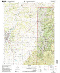
1999 Map of Cassville
USGS Topo · Published 2002About this map
Cassville serves as the central hub of this Missouri Ozark landscape, where the town’s grid meets the irregular topography of the Mark Twain National Forest. The map documents a community deeply connected to its springs and hollows, featuring numerous landmarks like the Crystal Caverns and the Cassville Ranger Station. Outside the main town, the geography is defined by a series of named hollows, including Corder Hollow, Galena Hollow, and Rockhouse Hollow, which provided the framework for early roads and scattered rural settlements.
Find a feature on this map
45 named features on this map. Tap any name to fly to it.
Don’t see what you’re looking for? This feature index may not catch every label — zoom into the map to look around manually.
Map Details
Editions of this 1999 Cassville Map
This is the sole edition of this map. No revisions or reprints were ever made.
Other maps of this area

1927 · Shell Knob
USGS Topo · 1:62,500

1937 · Cassville
USGS Topo · 1:48,000

1942 · Aurora
USGS Topo · 1:62,500

1943 · Monett
USGS Topo · 1:62,500

1944 · Cassville
USGS Topo · 1:62,500

1945 · Harrison
USGS Topo · 1:250,000

1945 · Aurora
USGS Topo · 1:62,500

1949 · Harrison
USGS Topo · 1:250,000

1950 · Shell Knob
USGS Topo · 1:62,500

1954 · Harrison
USGS Topo · 1:250,000