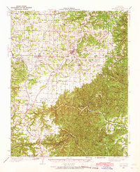
1937 Map of Cassville
USGS Topo · Published 1967About this map
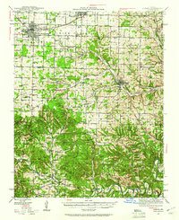
The town of Cassville serves as the central hub of this 1930s survey, surrounded by a dense network of rural school districts and family cemeteries that define the Barry County landscape. To the south, Roaring River State Park is already established, featuring a CCC Camp and the notable Roaring River Spring. The topography transitions from the agricultural Butterfield Flat in the north to the deeply incised hollows and ridges of the southern portion, where Panther Cave and a Natural Bridge mark the karst terrain. Railroad activity is prominent, with the St Louis San Francisco and Exeter and the Missouri and Arkansas lines connecting settlements like Exeter, Washburn, and Seligman. Genealogical interest is high throughout the area, with numerous rural landmarks such as True Love Cem, Washburn Prairie Sch, and the Sugar Camp Fire Tower providing precise points of reference for local history.
Find a feature on this map
100 named features on this map. Tap any name to fly to it.
Don’t see what you’re looking for? This feature index may not catch every label — zoom into the map to look around manually.
Map Details
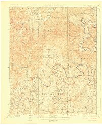
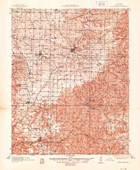
Editions of this 1937 Cassville Map
2 editions found
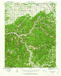
Other maps of this area

1899 · Fayetteville
USGS Topo · 1:125,000

1900 · Eureka Springs
USGS Topo · 1:125,000

1901 · Eureka Springs
USGS Topo · 1:125,000

1901 · Fayetteville
USGS Topo · 1:125,000

1904 · Fayetteville
USGS Topo · 1:125,000
1927 · Shell Knob
USGS Topo · 1:62,500
1937 · Cassville
USGS Topo · 1:48,000
1941 · Rocky Comfort
USGS Topo · 1:62,500
1942 · Aurora
USGS Topo · 1:62,500

1943 · Ritchey
USGS Topo · 1:62,500