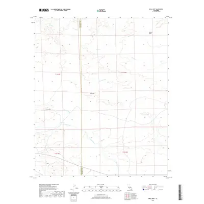
2018 Map of Shell Reef
USGS Topo · Published 2018About this map
Shell Reef stands as the central topographic landmark in this desert landscape, which straddles the boundary between San Diego and Imperial Counties. The terrain is defined by a network of seasonal drainage patterns, including the wide Tule Wash and Arroyo Salado to the north, and San Felipe Creek in the south. These ephemeral waterways create a complex system of alluvial fans and washes, such as Tarantula Wash and Palo Verde Wash, that dictate the movement of water through this arid portion of the Imperial Valley.
Find a feature on this map
16 named features on this map. Tap any name to fly to it.
Don’t see what you’re looking for? This feature index may not catch every label — zoom into the map to look around manually.
Map Details
Editions of this 2018 Shell Reef Map
This is the sole edition of this map. No revisions or reprints were ever made.
Other maps of this area

1904 · Indio
USGS Topo · 1:125,000

1931 · Vallecito
USGS Topo · 1:125,000

1940 · Kane Spring
USGS Topo · 1:62,500

1940 · Durmid
USGS Topo · 1:62,500

1942 · Barrel Spring
USGS Topo · 1:62,500

1942 · Agua Dulce
USGS Topo · 1:62,500

1943 · Vallecito
USGS Topo · 1:125,000

1944 · Agua Dulce
USGS Topo · 1:62,500

1944 · Durmid
USGS Topo · 1:62,500

1944 · Kane Spring
USGS Topo · 1:62,500