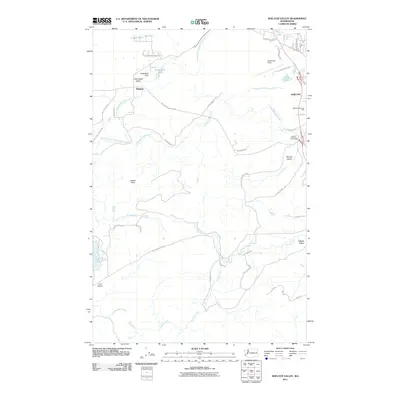
2011 Map of Shelton Valley
USGS Topo · Published 2011About this map
Goldsborough Creek and its many tributaries, including the North Fork and South Fork, define the drainage patterns of this Mason County landscape. Near the settlement of Dayton, the Uddenberg Dam sits just south of Little Egypt Valley and Armstrong Lake. The map details the western outskirts of Shelton, where the Shelton Memorial Park and the aviation grounds of Sanderson Field are prominent landmarks.
Find a feature on this map
52 named features on this map. Tap any name to fly to it.
Don’t see what you’re looking for? This feature index may not catch every label — zoom into the map to look around manually.
Map Details
Editions of this 2011 Shelton Valley Map
This is the sole edition of this map. No revisions or reprints were ever made.
Other maps of this area

1939 · Shelton
USGS Topo · 1:62,500

1943 · Potlatch
USGS Topo · 1:62,500

1943 · Nahwatzel Lake
USGS Topo · 1:62,500

1952 · Potlatch
USGS Topo · 1:62,500

1953 · Mt Tebo
USGS Topo · 1:62,500

1953 · Shelton
USGS Topo · 1:62,500

1953 · Elma
USGS Topo · 1:62,500

1958 · Seattle
USGS Topo · 1:250,000

1962 · Seattle
USGS Topo · 1:250,000
1981 · Mc Cleary
USGS Topo · 1:24,000