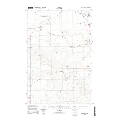
2014 Map of Shelton Valley
USGS Topo · Published 2014About this map
Shelton and its surrounding rural valleys define this corner of Mason County, where the landscape is carved by the intricate drainage of Goldsborough Cr and its various forks. The map reveals a transition from the urban fringes of the city and its industrial infrastructure, such as the Sanderson Field Airport, to the quiet agricultural and timbered basins of Shelton Valley and Isabella Valley. These low-lying areas are punctuated by small water bodies like Turtle Lake and Isabella Lake, which serve as focal points for the localized topography.
Find a feature on this map
90 named features on this map. Tap any name to fly to it.
Don’t see what you’re looking for? This feature index may not catch every label — zoom into the map to look around manually.
Map Details
Editions of this 2014 Shelton Valley Map
This is the sole edition of this map. No revisions or reprints were ever made.
Other maps of this area

1939 · Shelton
USGS Topo · 1:62,500

1943 · Potlatch
USGS Topo · 1:62,500

1943 · Nahwatzel Lake
USGS Topo · 1:62,500

1952 · Potlatch
USGS Topo · 1:62,500

1953 · Mt Tebo
USGS Topo · 1:62,500

1953 · Shelton
USGS Topo · 1:62,500

1953 · Elma
USGS Topo · 1:62,500

1958 · Seattle
USGS Topo · 1:250,000

1962 · Seattle
USGS Topo · 1:250,000
1981 · Mc Cleary
USGS Topo · 1:24,000