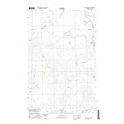
2017 Map of Shelton Valley
USGS Topo · Published 2017About this map
Shelton sits at the northeastern edge of this Mason County landscape, where the urban street grid gives way to the drainage networks of the Goldsborough Creek system. The map details the transition from the city toward the more agricultural and timber-oriented terrain of the Little Egypt Valley and Isabella Valley. Further west, the small settlement of Dayton anchors a landscape defined by sharp topographic shifts and a dense network of forest roads. The western half of the sheet is dominated by the ridges and drainages of the Olympic Peninsula foothills, illustrating how the natural topography has historically shaped the placement of rural homesteads and transport corridors outside the main city center.
Find a feature on this map
4 named features on this map. Tap any name to fly to it.
Don’t see what you’re looking for? This feature index may not catch every label — zoom into the map to look around manually.
Map Details
Editions of this 2017 Shelton Valley Map
This is the sole edition of this map. No revisions or reprints were ever made.
Other maps of this area

1939 · Shelton
USGS Topo · 1:62,500

1943 · Potlatch
USGS Topo · 1:62,500

1943 · Nahwatzel Lake
USGS Topo · 1:62,500

1952 · Potlatch
USGS Topo · 1:62,500

1953 · Mt Tebo
USGS Topo · 1:62,500

1953 · Shelton
USGS Topo · 1:62,500

1953 · Elma
USGS Topo · 1:62,500

1958 · Seattle
USGS Topo · 1:250,000

1962 · Seattle
USGS Topo · 1:250,000
1981 · Mc Cleary
USGS Topo · 1:24,000