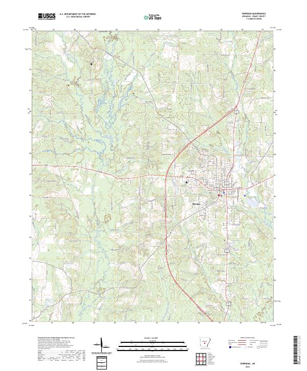
2024 Map of Sheridan
USGS Topo · Published 2024About this map
The Grant County Courthouse serves as the central landmark for Sheridan, which dominates the eastern portion of this Arkansas landscape. The town is defined by a dense street grid that transitions into a network of outlying roads such as Robertson Rd and Lankford Rd. Local history is anchored by sites like Poe Cem and Lost Creek Cem, providing tangible points for genealogical research.
Find a feature on this map
137 named features on this map. Tap any name to fly to it.
Don’t see what you’re looking for? This feature index may not catch every label — zoom into the map to look around manually.
Map Details
Editions of this 2024 Sheridan Map
This is the sole edition of this map. No revisions or reprints were ever made.
Other maps of this area

1955 · Little Rock
USGS Topo · 1:250,000

1956 · Little Rock
USGS Topo · 1:250,000

1960 · Little Rock
USGS Topo · 1:250,000

1963 · Prattsville
USGS Topo · 1:24,000
1963 · Tull
USGS Topo · 1:24,000

1964 · Little Rock
USGS Topo · 1:250,000

1964 · Sheridan
USGS Topo · 1:24,000

1964 · Cane Creek
USGS Topo · 1:24,000

1964 · Belfast
USGS Topo · 1:24,000
1964 · Millerville
USGS Topo · 1:24,000