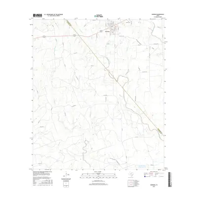
2016 Map of Sheridan
USGS Topo · Published 2016About this map
Sheridan anchors this landscape in the southeastern corner of the Texas coastal plains, where a grid of residential streets like Main St and Avenue E meets the rural agricultural hinterland. The town’s location is defined by its proximity to the winding waters of West Sandy Creek and Urmey Br, which drain the low-lying terrain. Just outside the settlement, the Cheetham Cem offers a focal point for genealogical research, while the surrounding land is marked by long-standing ranching and industrial roads such as Shell Plant Rd and Briscoe Ranch Rd.
Find a feature on this map
65 named features on this map. Tap any name to fly to it.
Don’t see what you’re looking for? This feature index may not catch every label — zoom into the map to look around manually.
Map Details
Editions of this 2016 Sheridan Map
This is the sole edition of this map. No revisions or reprints were ever made.
Other maps of this area

1919 · Schulenburg
USGS Topo · 1:62,500

1953 · Seguin
USGS Topo · 1:250,000

1956 · Glidden
USGS Topo · 1:62,500

1958 · Seguin
USGS Topo · 1:250,000

1962 · Sublime
USGS Topo · 1:24,000

1962 · Hallettsville SE
USGS Topo · 1:24,000

1964 · Speaks
USGS Topo · 1:24,000

1965 · Oakland
USGS Topo · 1:24,000

1965 · Sawmill Branch
USGS Topo · 1:24,000

1965 · Rock Island
USGS Topo · 1:24,000