
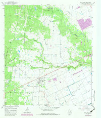
1965 Map of Rock Island
USGS Topo · Published 1967About this map
Rock Island stands as a central settlement in Colorado County, Texas, during the mid-1960s, defined by its position along the Southern Pacific railroad. The landscape is a complex drainage basin where Skull Creek and Crasco Creek wind through a mix of woodland and open spaces like Buzzard Prairie. This survey captures the rural infrastructure of the era, from the numerous Gravel Pits dotting the terrain to the expansive network of pipelines and the Leher Canal in the southeast. Local history is anchored by landmarks such as Myrtle Cem south of the main townsite. The presence of smaller water bodies like Griffin Lake, Prairie Lake, and Black Lake suggests a low-lying, water-rich environment that influenced early settlement patterns and land use in this part of Southeast Texas.
Find a feature on this map
18 named features on this map. Tap any name to fly to it.
Don’t see what you’re looking for? This feature index may not catch every label — zoom into the map to look around manually.
Map Details
Editions of this 1965 Rock Island Map
2 editions found
Other maps of this area

1953 · Seguin
USGS Topo · 1:250,000

1956 · Glidden
USGS Topo · 1:62,500

1957 · Eagle Lake
USGS Topo · 1:62,500

1957 · Altair
USGS Topo · 1:24,000

1957 · Columbus
USGS Topo · 1:24,000

1957 · Borden
USGS Topo · 1:24,000

1958 · Seguin
USGS Topo · 1:250,000

1958 · Alleyton
USGS Topo · 1:24,000

1959 · Garwood
USGS Topo · 1:24,000

1965 · Sawmill Branch
USGS Topo · 1:24,000