
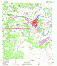
1957 Map of Columbus
USGS Topo · Published 1958About this map
The Colorado River carves a dramatic loop around Columbus, where mid-century transportation and extraction industries converge. The town's grid is bisected by the Southern Pacific railroad and the Texas and New Orleans Highway, while the historic Old Spanish Trail cuts through the southern landscape. This era shows a community built on a diverse economic base, ranging from the Columbus Oil Field in the north to numerous strip mines and gravel pits scattered along the riverbanks.
Find a feature on this map
36 named features on this map. Tap any name to fly to it.
Don’t see what you’re looking for? This feature index may not catch every label — zoom into the map to look around manually.
Map Details
Editions of this 1957 Columbus Map
2 editions found
Other maps of this area

1919 · Fayettsville
USGS Topo · 1:62,500

1953 · Seguin
USGS Topo · 1:250,000

1956 · Bellville
USGS Topo · 1:62,500

1956 · Glidden
USGS Topo · 1:62,500

1957 · Eagle Lake
USGS Topo · 1:62,500

1957 · Ellinger
USGS Topo · 1:24,000

1957 · Altair
USGS Topo · 1:24,000

1957 · Borden
USGS Topo · 1:24,000

1958 · Seguin
USGS Topo · 1:250,000

1958 · Frelsburg
USGS Topo · 1:24,000