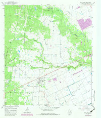
1965 Map of Rock Island
USGS Topo · Published 1983About this map
Rock Island sits at the heart of this coastal prairie landscape, where the Southern Pacific railroad cuts a straight line through the Colorado County terrain. The 1965 topography reveals a community shaped by both ranching and natural drainage, with the sprawling Buzzard Prairie and Griffin Lake to the north. Water management is a central theme, evidenced by the Leher Canal in the southeast and the winding paths of Skull Creek and Crasco Creek.
Find a feature on this map
21 named features on this map. Tap any name to fly to it.
Don’t see what you’re looking for? This feature index may not catch every label — zoom into the map to look around manually.
Map Details
Editions of this 1965 Rock Island Map
2 editions found

Other maps of this area

1953 · Seguin
USGS Topo · 1:250,000

1956 · Glidden
USGS Topo · 1:62,500

1957 · Eagle Lake
USGS Topo · 1:62,500

1957 · Altair
USGS Topo · 1:24,000

1957 · Columbus
USGS Topo · 1:24,000

1957 · Borden
USGS Topo · 1:24,000

1958 · Seguin
USGS Topo · 1:250,000

1958 · Alleyton
USGS Topo · 1:24,000

1959 · Garwood
USGS Topo · 1:24,000

1965 · Sawmill Branch
USGS Topo · 1:24,000