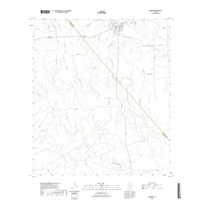
2019 Map of Sheridan
USGS Topo · Published 2019About this map
Sheridan is the central hub of this South Texas landscape, situated along the county line where Colorado Co meets Lavaca County. The town site follows a structured grid of residential streets such as Main St and First St, bordering the historic Cheetham Cem to the east. The surrounding terrain is defined by a dense drainage network feeding into the Navidad River watershed. Numerous watercourses, including West Sandy Creek, Middle Sandy Creek, and the branching arms of Ragsdale Creek, weave through the countryside. This modern survey illustrates the persistent rural character of the region, where a network of gravel and private roads like Old Varley Ln and Shell Plant Rd connect dispersed agricultural operations and creek-bottom timberlands.
Find a feature on this map
66 named features on this map. Tap any name to fly to it.
Don’t see what you’re looking for? This feature index may not catch every label — zoom into the map to look around manually.
Map Details
Editions of this 2019 Sheridan Map
This is the sole edition of this map. No revisions or reprints were ever made.
Other maps of this area

1919 · Schulenburg
USGS Topo · 1:62,500

1953 · Seguin
USGS Topo · 1:250,000

1956 · Glidden
USGS Topo · 1:62,500

1958 · Seguin
USGS Topo · 1:250,000

1962 · Sublime
USGS Topo · 1:24,000

1962 · Hallettsville SE
USGS Topo · 1:24,000

1964 · Speaks
USGS Topo · 1:24,000

1965 · Oakland
USGS Topo · 1:24,000

1965 · Sawmill Branch
USGS Topo · 1:24,000

1965 · Rock Island
USGS Topo · 1:24,000