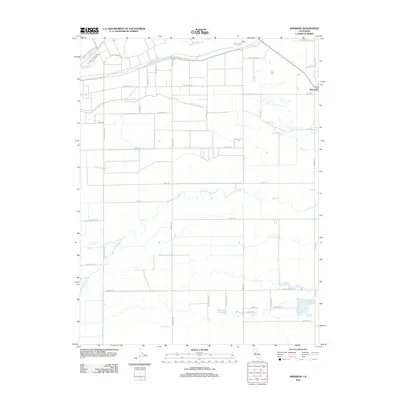
2012 Map of Sheridan
USGS Topo · Published 2012About this map
Sheridan anchors this landscape in the northern Central Valley, positioned near the junction of several drainage systems and major county thoroughfares. The terrain is defined by a dense network of seasonal and perennial waterways, including the prominent Bear River and the meandering Coon Cr, which traverse an area largely partitioned for agricultural use. Historically significant sloughs such as Grasshopper Slough, Yankee Slough, and Bunkham Slough cut across the low-lying plains, indicating the complex hydrology required to manage this fertile region. The settlement of Sheridan itself is identified with its Po, serving as a localized hub for the surrounding rural road network. Notable transit corridors like Pleasant Grove Rd and Wheatland Rd provide a structured framework for the dispersed homesteads and farms that characterize this part of Yuba County.
Find a feature on this map
49 named features on this map. Tap any name to fly to it.
Don’t see what you’re looking for? This feature index may not catch every label — zoom into the map to look around manually.
Map Details
Editions of this 2012 Sheridan Map
This is the sole edition of this map. No revisions or reprints were ever made.
Other maps of this area

1888 · Marysville
USGS Topo · 1:125,000

1888 · Smartsville
USGS Topo · 1:125,000

1891 · Sacramento
USGS Topo · 1:125,000

1891 · Marysville
USGS Topo · 1:125,000

1891 · Smartsville
USGS Topo · 1:125,000

1892 · Sacramento
USGS Topo · 1:125,000

1892 · Smartsville
USGS Topo · 1:125,000

1893 · Sacramento
USGS Topo · 1:125,000

1894 · Smartsville
USGS Topo · 1:125,000

1894 · Marysville
USGS Topo · 1:125,000