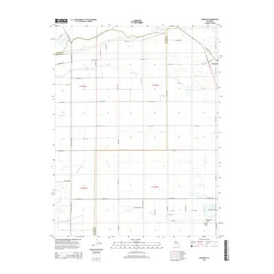
2015 Map of Sheridan
USGS Topo · Published 2015About this map
The town of Sheridan anchors the northeastern corner of this 2015 study of the California landscape at the border of Sutter, Placer, and Yuba Counties. Positioned within the Sacramento Valley, the region is defined by an intricate network of waterways including the Bear River and the meandering Coon Cr. The terrain is characterized by numerous sloughs, such as Grasshopper Slough, Yankee Slough, and Bunkham Slough, which illustrate the complex drainage patterns of the Central Valley.
Find a feature on this map
55 named features on this map. Tap any name to fly to it.
Don’t see what you’re looking for? This feature index may not catch every label — zoom into the map to look around manually.
Map Details
Editions of this 2015 Sheridan Map
This is the sole edition of this map. No revisions or reprints were ever made.
Other maps of this area

1888 · Marysville
USGS Topo · 1:125,000

1888 · Smartsville
USGS Topo · 1:125,000

1891 · Sacramento
USGS Topo · 1:125,000

1891 · Marysville
USGS Topo · 1:125,000

1891 · Smartsville
USGS Topo · 1:125,000

1892 · Sacramento
USGS Topo · 1:125,000

1892 · Smartsville
USGS Topo · 1:125,000

1893 · Sacramento
USGS Topo · 1:125,000

1894 · Smartsville
USGS Topo · 1:125,000

1894 · Marysville
USGS Topo · 1:125,000