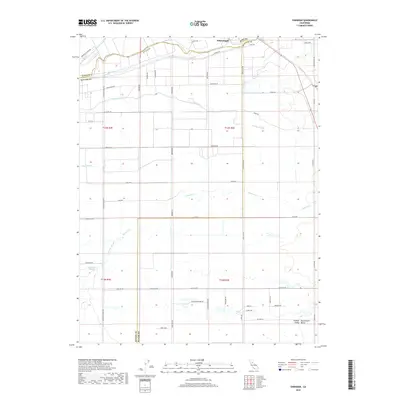
2018 Map of Sheridan
USGS Topo · Published 2018About this map
Wheatland anchors the northeastern corner of this agricultural landscape in the Central Sacramento Valley, where the borders of Yuba, Placer, and Sutter counties converge. The terrain is defined by its complex hydrology, with the Bear River and Dry Cr cutting across the northern reaches while a network of seasonal drainages, including Yankee Slough and Raccoon Cr, meander through the southern fields. The grid-like road system, featuring routes like Pleasant Grove Rd and Nicolaus Ave, reflects a highly organized rural infrastructure built around the valley's flood control measures, indicated by the presence of Levee Rd. Water management is central to the area's identity, as seen in the various sloughs like Bunkham Slough and Ping Slough that provide drainage across the low-lying plains.
Find a feature on this map
53 named features on this map. Tap any name to fly to it.
Don’t see what you’re looking for? This feature index may not catch every label — zoom into the map to look around manually.
Map Details
Editions of this 2018 Sheridan Map
This is the sole edition of this map. No revisions or reprints were ever made.
Other maps of this area

1888 · Marysville
USGS Topo · 1:125,000

1888 · Smartsville
USGS Topo · 1:125,000

1891 · Sacramento
USGS Topo · 1:125,000

1891 · Marysville
USGS Topo · 1:125,000

1891 · Smartsville
USGS Topo · 1:125,000

1892 · Sacramento
USGS Topo · 1:125,000

1892 · Smartsville
USGS Topo · 1:125,000

1893 · Sacramento
USGS Topo · 1:125,000

1894 · Smartsville
USGS Topo · 1:125,000

1894 · Marysville
USGS Topo · 1:125,000