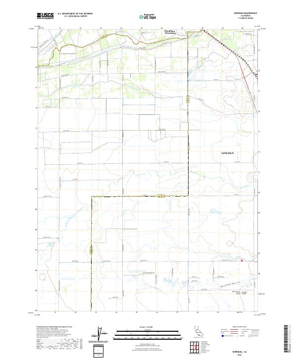
2022 Map of Sheridan
USGS Topo · Published 2022About this map
The Sacramento Central Valley landscape near the junction of Placer, Sutter, and Yuba counties is defined by a complex network of drainage channels and irrigation infrastructure. The northern edge of the map features the established settlement of Wheatland, situated near the banks of Dry Creek. To the southeast, the growing footprint of Lincoln marks the transition into the foothill plains. The intervening terrain is an intricate grid of agricultural roads, including Pleasant Grove Rd and Brewer Rd, which navigate around meandering water features like Yankee Slough and Raccoon Creek.
Find a feature on this map
54 named features on this map. Tap any name to fly to it.
Don’t see what you’re looking for? This feature index may not catch every label — zoom into the map to look around manually.
Map Details
Editions of this 2022 Sheridan Map
This is the sole edition of this map. No revisions or reprints were ever made.
Other maps of this area

1888 · Marysville
USGS Topo · 1:125,000

1888 · Smartsville
USGS Topo · 1:125,000

1891 · Sacramento
USGS Topo · 1:125,000

1891 · Marysville
USGS Topo · 1:125,000

1891 · Smartsville
USGS Topo · 1:125,000

1892 · Sacramento
USGS Topo · 1:125,000

1892 · Smartsville
USGS Topo · 1:125,000

1893 · Sacramento
USGS Topo · 1:125,000

1894 · Smartsville
USGS Topo · 1:125,000

1894 · Marysville
USGS Topo · 1:125,000