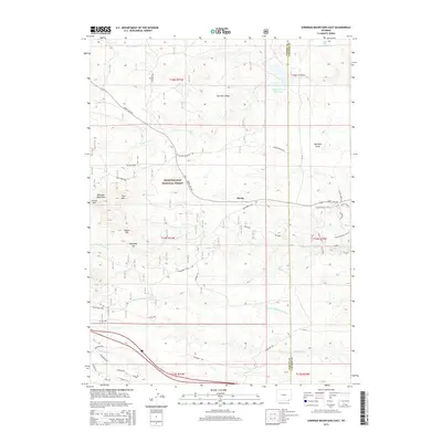
2015 Map of Sherman Mountains East
USGS Topo · Published 2015About this map
Medicine Bow National Forest dominates the high-altitude topography where the borders of Albany and Laramie Counties meet. The landscape is defined by the massive granite outcrops of the Sherman Mountains, including prominent elevations like Twin Mtn, Egbert Hill, and Reynolds Hill. This 2015 survey details a complex network of recreational and access routes, such as the Stone Temple Circuit and Vedauwoo Glen Rd, which weave through the distinctive rock formations.
Find a feature on this map
42 named features on this map. Tap any name to fly to it.
Don’t see what you’re looking for? This feature index may not catch every label — zoom into the map to look around manually.
Map Details
Editions of this 2015 Sherman Mountains East Map
This is the sole edition of this map. No revisions or reprints were ever made.
Other maps of this area

1905 · Sherman
USGS Topo · 1:125,000

1948 · Sherman Mountains
USGS Topo · 1:62,500

1948 · Ragged Top Mountain
USGS Topo · 1:62,500

1950 · Ragged Top Mountain
USGS Topo · 1:62,500

1950 · Sherman Mountains
USGS Topo · 1:62,500

1954 · Cheyenne
USGS Topo · 1:250,000

1958 · Cheyenne
USGS Topo · 1:250,000
1962 · Hecla
USGS Topo · 1:24,000
1962 · Islay
USGS Topo · 1:24,000
1962 · Granite
USGS Topo · 1:24,000