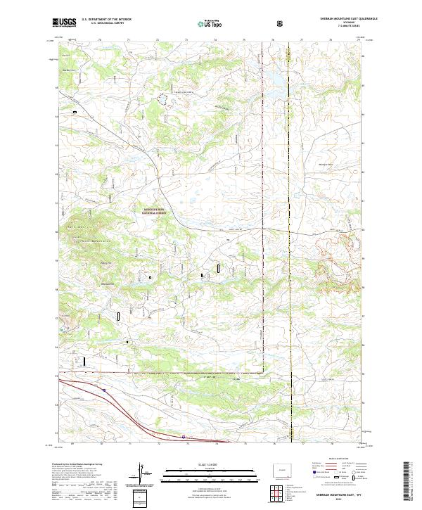
2021 Map of Sherman Mountains East
USGS Topo · Published 2021About this map
Sherman Mountains define the high-elevation landscape of this region within the Medicine Bow National Forest. The map captures a complex network of forest roads and trails that navigate a series of granite formations and peaks, including Turtle Rock and Twin Mtn. This area serves as a critical watershed for the high plains, with the headwaters of numerous streams such as Middle Crow Cr, S Crow Cr, and Lone Tree Cr flowing eastward from the continental divide. The infrastructure revealed, from the Vedauwoo Glen Rd to the historic Buford Trl, illustrates the modern management and recreational use of these public lands. Significant summits like Egbert Hill, Reynolds Hill, and Markley Hill provide distinct vertical relief across the quadrangle, which straddles the border between Albany and Laramie Counties.
Find a feature on this map
49 named features on this map. Tap any name to fly to it.
Don’t see what you’re looking for? This feature index may not catch every label — zoom into the map to look around manually.
Map Details
Editions of this 2021 Sherman Mountains East Map
This is the sole edition of this map. No revisions or reprints were ever made.
Other maps of this area

1905 · Sherman
USGS Topo · 1:125,000

1948 · Sherman Mountains
USGS Topo · 1:62,500

1948 · Ragged Top Mountain
USGS Topo · 1:62,500

1950 · Ragged Top Mountain
USGS Topo · 1:62,500

1950 · Sherman Mountains
USGS Topo · 1:62,500

1954 · Cheyenne
USGS Topo · 1:250,000

1958 · Cheyenne
USGS Topo · 1:250,000
1962 · Hecla
USGS Topo · 1:24,000
1962 · Islay
USGS Topo · 1:24,000
1962 · Granite
USGS Topo · 1:24,000