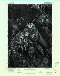
1975 Map of Sherman NE
USGS Topo · Published 1980About this map
Golden Ridge and its surrounding agricultural patchwork define the landscape of this 1975 orthophotoquad in Aroostook County. Unlike a traditional topographic map, this aerial survey provides a clear view of the cleared farm fields and woodlots that characterize this part of Maine. To the south, the deep waters of Macwahoc Lake stand out against the dense forest cover, while Cold Brook meanders through the northern terrain. The imagery captures the specific land-use patterns of the mid-1970s, showing the precise boundaries of rural holdings and the winding path of the local road network connecting these remote settlements.
Find a feature on this map
3 named features on this map. Tap any name to fly to it.
Don’t see what you’re looking for? This feature index may not catch every label — zoom into the map to look around manually.
Map Details
Editions of this 1975 Sherman NE Map
This is the sole edition of this map. No revisions or reprints were ever made.
Other maps of this area

1937 · Smyrna Mills
USGS Topo · 1:62,500

1940 · Island Falls
USGS Topo · 1:62,500

1940 · Sherman
USGS Topo · 1:62,500

1941 · Mattawamkeag Lake
USGS Topo · 1:62,500

1942 · Island Falls
USGS Topo · 1:62,500

1942 · Sherman
USGS Topo · 1:62,500

1943 · Mattawamkeag Lake
USGS Topo · 1:62,500

1954 · Presque Isle
USGS Topo · 1:250,000

1954 · Millinocket
USGS Topo · 1:250,000

1955 · Smyrna Mills
USGS Topo · 1:62,500