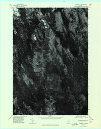
1975 Map of Sherman SE
USGS Topo · Published 1980About this map
Silver Ridge and Monarda anchor the rural landscape of this Aroostook County orthophotoquad, where the clearing patterns of mid-1970s Maine forestry and agriculture are preserved in high-contrast aerial detail. Unlike a standard topographic map, this survey uses rectified photography to document the precise edge of woodlots and fields along the north-south transport corridors. The western edge is defined by the significant waters of Plunkett Pond, while the eastern terrain is drained by the winding courses of Molunkus Stream and Gulliver Brook. The resulting image provides a rare visual record of land use and timber harvesting patterns in the Maine woods before modern expansion, showing the relationship between small-scale settlements and the surrounding wilderness.
Find a feature on this map
5 named features on this map. Tap any name to fly to it.
Don’t see what you’re looking for? This feature index may not catch every label — zoom into the map to look around manually.
Map Details
Editions of this 1975 Sherman SE Map
This is the sole edition of this map. No revisions or reprints were ever made.
Other maps of this area

1940 · Sherman
USGS Topo · 1:62,500

1940 · Mattawamkeag
USGS Topo · 1:62,500

1941 · Mattawamkeag Lake
USGS Topo · 1:62,500

1941 · Wytopitlock
USGS Topo · 1:62,500

1942 · Mattawamkeag
USGS Topo · 1:62,500

1942 · Sherman
USGS Topo · 1:62,500

1943 · Wytopitlock
USGS Topo · 1:62,500

1943 · Mattawamkeag Lake
USGS Topo · 1:62,500

1954 · Millinocket
USGS Topo · 1:250,000

1958 · Millinocket
USGS Topo · 1:250,000