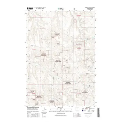
2015 Map of Sherrard Hill
USGS Topo · Published 2015About this map
Sherrard Hill and the Bear Lodge Mountains define this section of Crook County, characterized by the dense management boundaries of the Black Hills National Forest. The landscape is a network of ridgelines and drainages, where Brimmer Divide separates northern watersheds from the complex canyon systems to the south. Modern forest access is carved through the terrain via Whitetail Creek Rd and Lytle Creek Rd, reflecting a landscape dedicated to timber management and outdoor recreation. Water resources are concentrated in features like the Blacktail Reservoir and the winding course of Lytle Cr. This map documents the persistent geography of the Black Hills, showing how high points like Manly Hill and Newton Hill serve as anchors within the vast public forest lands of northeast Wyoming.
Find a feature on this map
35 named features on this map. Tap any name to fly to it.
Don’t see what you’re looking for? This feature index may not catch every label — zoom into the map to look around manually.
Map Details
Editions of this 2015 Sherrard Hill Map
This is the sole edition of this map. No revisions or reprints were ever made.
Other maps of this area

1898 · Sundance
USGS Topo · 1:125,000

1901 · Aladdin
USGS Topo · 1:125,000

1902 · Sundance
USGS Topo · 1:125,000

1903 · Aladdin
USGS Topo · 1:125,000

1905 · Devils Tower
USGS Topo · 1:125,000

1918 · Moorcroft
USGS Topo · 1:125,000

1954 · Sunny Divide
USGS Topo · 1:24,000

1954 · Storm Hill
USGS Topo · 1:24,000

1954 · Gillette
USGS Topo · 1:250,000

1955 · Devils Tower
USGS Topo · 1:62,500