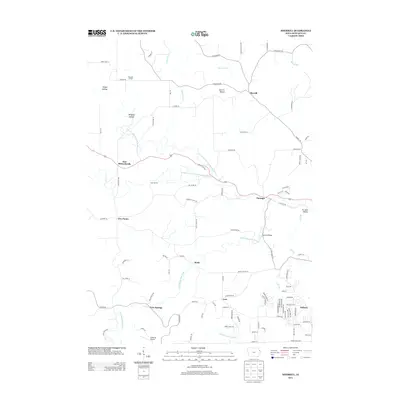
2013 Map of Sherrill
USGS Topo · Published 2013About this map
Sherrill Mound stands as a prominent landmark overlooking a network of valleys carved by the N Fork Little Maquoketa River and its tributaries. This 2013 survey of northeastern Dubuque County reveals a landscape where small hamlets like Durango and East Rickardsville are linked by winding roads through local terrain such as Mangold Hollow and Stegar Hollow. The map captures the suburban growth of Asbury pressing against older rural outposts and family-named features. Education and recreation are represented by Mangold School and Camp Burton, while the presence of Anderson Airport and Rodford Bridge highlights the area's transportation infrastructure. Streams such as Cloie Br and Bloody Run drain the rolling countryside, illustrating the transition from traditional Iowa farmland to more modern residential developments.
Find a feature on this map
100 named features on this map. Tap any name to fly to it.
Don’t see what you’re looking for? This feature index may not catch every label — zoom into the map to look around manually.
Map Details
Editions of this 2013 Sherrill Map
This is the sole edition of this map. No revisions or reprints were ever made.
Other maps of this area

1900 · Lancaster
USGS Topo · 1:125,000

1901 · Peosta
USGS Topo · 1:125,000

1904 · Lancaster
USGS Topo · 1:125,000

1908 · Lancaster
USGS Topo · 1:125,000

1935 · East Dubuque
USGS Topo · 1:62,500

1940 · East Dubuque
USGS Topo · 1:62,500

1955 · Cassville
USGS Topo · 1:24,000

1955 · Dubuque South
USGS Topo · 1:24,000

1955 · Balltown
USGS Topo · 1:24,000

1956 · Dubuque North
USGS Topo · 1:24,000