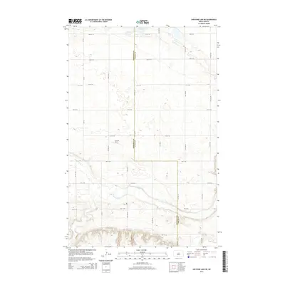
2014 Map of Sheyenne Lake NE
USGS Topo · Published 2014About this map
The Sheyenne River meanders across the southern landscape of this Wells County and Sheridan County border region, carving a distinct valley through the prairie. The upland areas are defined by a sparse network of section-line roads, including 24th Ave NE, which follows the county boundary. Evidence of early settlement and rural infrastructure is anchored by Zion Cem, a key landmark for genealogical research in this sparsely populated township. The presence of the Lonetree Airstrip in the western section of the map highlights the modern utility of these open plains. To the north, Sorenson Lake sits amidst a collection of smaller prairie potholes and wetlands, illustrating the post-glacial drainage patterns characteristic of the North Dakota interior.
Find a feature on this map
23 named features on this map. Tap any name to fly to it.
Don’t see what you’re looking for? This feature index may not catch every label — zoom into the map to look around manually.
Map Details
Editions of this 2014 Sheyenne Lake NE Map
This is the sole edition of this map. No revisions or reprints were ever made.
Other maps of this area

1940 · Aylmer
USGS Topo · 1:62,500

1941 · Selz
USGS Topo · 1:62,500

1945 · Manfred
USGS Topo · 1:62,500

1946 · Sheyenne Lake
USGS Topo · 1:48,000

1947 · Sheyenne Lake
USGS Topo · 1:62,500

1948 · Manfred
USGS Topo · 1:62,500

1949 · Manfred SW
USGS Topo · 1:24,000

1950 · Manfred NW
USGS Topo · 1:24,000

1950 · Sheyenne Lake NE
USGS Topo · 1:24,000

1950 · Sheyenne Lake
USGS Topo · 1:24,000