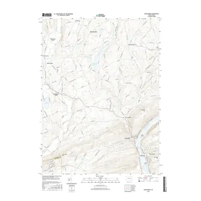
2016 Map of Shickshinny
USGS Topo · Published 2016About this map
The Susquehanna River cuts a deep path through this portion of Luzerne County, defining the local geography as it flows past the borough of Shickshinny and the riverside community of Mocanaqua. This area of the Anthracite Valley is characterized by steep ridges like Shickshinny Mtn and Huntington Mtn, which frame the various creek valleys. To the northwest, the landscape transitions into a network of small agricultural and residential settlements including Huntington Mills and Harveyville. The map shows a high density of rural burial grounds, such as Saint Casimirs Cem and the Pine Grove Cem, which serve as vital points of reference for genealogical research in these townships. Water remains a central feature of the terrain, from the industrial legacy of Paper Mill Pond to recreational bodies like Shickshinny Lake and Hiland Lake, while Bellis Island and Little Island sit prominently within the river channel.
Find a feature on this map
111 named features on this map. Tap any name to fly to it.
Don’t see what you’re looking for? This feature index may not catch every label — zoom into the map to look around manually.
Map Details
Editions of this 2016 Shickshinny Map
This is the sole edition of this map. No revisions or reprints were ever made.
Other maps of this area

1891 · Harveys Lake
USGS Topo · 1:62,500

1893 · Harvey Lake
USGS Topo · 1:62,500

1894 · Shickshinny
USGS Topo · 1:62,500

1894 · Bloomsburg
USGS Topo · 1:62,500

1934 · Laporte
USGS Topo · 1:62,500

1946 · Sybertsville
USGS Topo · 1:31,680

1946 · Nanticoke
USGS Topo · 1:31,680

1946 · Shickshinny
USGS Topo · 1:31,680

1946 · Berwick
USGS Topo · 1:31,680

1946 · Harveys Lake
USGS Topo · 1:24,000
Featured Places
- Hunlock Township, PA
- Conyngham Township, PA
- Shickshinny, PA
- Mocanaqua, Conyngham Township
- Muhlenburg, Union Township