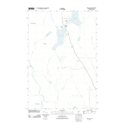
2011 Map of Shin Pond
USGS Topo · Published 2011About this map
Shin Pond serves as a central hub for this Penobscot County landscape, where the waters of Upper Shin Pond and Lower Shin Pond meet a network of mountain ridges and remote brooks. The map illustrates a specialized transportation and recreation infrastructure, notably the Shin Pond Seaplane Base and the Shin Pond Village Campground, which cater to those navigating the Maine backcountry. Higher elevations like Sugarloaf Mountain and Peaked Mountain frame the horizon, while the Seboeis River and Fish Stream define the lower drainage basins. This 2011 survey captures the area's transition from traditional logging territory to a modern recreational destination, shown through named local roads such as Grondins Rd and Bald Eagle Ln that lead into the timberlands. The terrain is marked by a complex series of waterways, including Kimball Brook and Sucker Brook, which feed into the larger ponds and rivers characterizing this northern wilderness.
Find a feature on this map
34 named features on this map. Tap any name to fly to it.
Don’t see what you’re looking for? This feature index may not catch every label — zoom into the map to look around manually.
Map Details
Editions of this 2011 Shin Pond Map
This is the sole edition of this map. No revisions or reprints were ever made.
Other maps of this area

1940 · Island Falls
USGS Topo · 1:62,500

1940 · Sherman
USGS Topo · 1:62,500

1942 · Island Falls
USGS Topo · 1:62,500

1942 · Sherman
USGS Topo · 1:62,500

1953 · Stacyville
USGS Topo · 1:62,500

1954 · Shin Pond
USGS Topo · 1:62,500

1954 · Presque Isle
USGS Topo · 1:250,000

1954 · Millinocket
USGS Topo · 1:250,000

1958 · Presque Isle
USGS Topo · 1:250,000

1958 · Millinocket
USGS Topo · 1:250,000