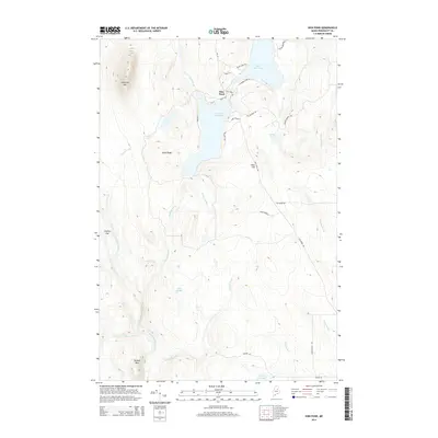
2014 Map of Shin Pond
USGS Topo · Published 2014About this map
Shin Pond serves as the central hub of this northern Maine landscape, where the waters of Upper Shin Pond and Lower Shin Pond are divided by a narrow land bridge carrying Me 159. The settlement here is surrounded by a dense network of waterways including Shin Brook, Fish Stream, and the Schoois River, which drain the varied elevations of the Penobscot County interior. High points such as Sugarloaf Mtn in the northwest and Peaked Mtn in the south provide significant relief over the low-lying basins of Gagnon Flat and the surrounding marshlands.
Find a feature on this map
38 named features on this map. Tap any name to fly to it.
Don’t see what you’re looking for? This feature index may not catch every label — zoom into the map to look around manually.
Map Details
Editions of this 2014 Shin Pond Map
This is the sole edition of this map. No revisions or reprints were ever made.
Other maps of this area

1940 · Island Falls
USGS Topo · 1:62,500

1940 · Sherman
USGS Topo · 1:62,500

1942 · Island Falls
USGS Topo · 1:62,500

1942 · Sherman
USGS Topo · 1:62,500

1953 · Stacyville
USGS Topo · 1:62,500

1954 · Shin Pond
USGS Topo · 1:62,500

1954 · Presque Isle
USGS Topo · 1:250,000

1954 · Millinocket
USGS Topo · 1:250,000

1958 · Presque Isle
USGS Topo · 1:250,000

1958 · Millinocket
USGS Topo · 1:250,000