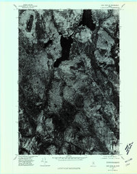
1975 Map of Shin Pond SE
USGS Topo · Published 1980About this map
Shin Pond anchors the northern landscape of this 1975 orthophotoquad, which captures the forested interior of Penobscot County during the mid-1970s. This aerial-derived survey provides a rare, direct visual record of the northern Maine woods before contemporary large-scale timber management altered much of the canopy. The orthophoto reveals the fine textures of the dense timberlands, showing the winding logging roads and small clearings that supported the local forest economy. Unlike traditional topographic maps that use symbols for land cover, this imagery displays the actual density of the stands and the exact shoreline of the water bodies, offering researchers a literal snapshot of the environment as it existed on October 9, 1975.
Find a feature on this map
1 named feature on this map. Tap any name to fly to it.
Don’t see what you’re looking for? This feature index may not catch every label — zoom into the map to look around manually.
Map Details
Editions of this 1975 Shin Pond SE Map
This is the sole edition of this map. No revisions or reprints were ever made.
Other maps of this area

1940 · Island Falls
USGS Topo · 1:62,500

1940 · Sherman
USGS Topo · 1:62,500

1942 · Island Falls
USGS Topo · 1:62,500

1942 · Sherman
USGS Topo · 1:62,500

1953 · Stacyville
USGS Topo · 1:62,500

1954 · Shin Pond
USGS Topo · 1:62,500

1954 · Presque Isle
USGS Topo · 1:250,000

1954 · Millinocket
USGS Topo · 1:250,000

1958 · Presque Isle
USGS Topo · 1:250,000

1958 · Millinocket
USGS Topo · 1:250,000