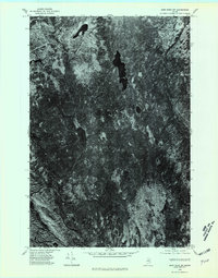
1975 Map of Shin Pond SW
USGS Topo · Published 1980About this map
Jerry Pond and Bowlin Pond anchor this 1975 orthophotoquad of the Maine wilderness. Unlike a traditional topographic map, this survey uses rectified aerial photography taken in October of 1975 to provide a direct visual record of the forest canopy and hydrology. The dark, elongated forms of these water bodies contrast against the dense timberland, revealing the natural drainage patterns and the primitive road or trail network cutting through the brush. For researchers of the Penobscot region, this imagery captures the exact state of the working forest and shoreline before later decades of growth and development altered the landscape, offering a literal look at the ground as it appeared during the mid-seventies.
Find a feature on this map
2 named features on this map. Tap any name to fly to it.
Don’t see what you’re looking for? This feature index may not catch every label — zoom into the map to look around manually.
Map Details
Editions of this 1975 Shin Pond SW Map
This is the sole edition of this map. No revisions or reprints were ever made.
Other maps of this area

1927 · Katahdin
USGS Topo · 1:48,000

1930 · Katahdin
USGS Topo · 1:62,500

1949 · Katahdin
USGS Topo · 1:62,500

1953 · Stacyville
USGS Topo · 1:62,500

1954 · Shin Pond
USGS Topo · 1:62,500

1954 · Presque Isle
USGS Topo · 1:250,000

1954 · Millinocket
USGS Topo · 1:250,000

1955 · Traveler Mountain
USGS Topo · 1:62,500

1958 · Presque Isle
USGS Topo · 1:250,000

1958 · Millinocket
USGS Topo · 1:250,000