
1931 Map of Shingleton NE
USGS Topo · Published 1931About this map
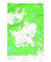
The Creighton River and Marsh Creek dominate this 1931 survey of the Michigan Upper Peninsula, where the landscape is defined by extensive wetlands and a network of isolated glacial lakes. The border between Alger and Schoolcraft counties runs through this sparsely settled terrain, highlighting a wilderness character where landmarks are primarily natural features or fire protection infrastructure. The Buck Hill Fire Tower stands as a primary vantage point in the northwest corner, overlooking a region where the only industrial footprint is the L S and Ishpeming railroad cutting through the central marshes. Smaller water bodies like Big Cedar Lake, Wolf Lake, and Spider Lake are scattered across the quadrangle, illustrating the complex drainage patterns of the area before modern development altered the local hydrology. This advance sheet was notably compiled in part from aerial photographs taken by the Army Air Corps, representing an early application of photogrammetry in mapping this difficult-to-traverse environment.
Find a feature on this map
18 named features on this map. Tap any name to fly to it.
Don’t see what you’re looking for? This feature index may not catch every label — zoom into the map to look around manually.
Map Details
Editions of this 1931 Shingleton NE Map
This is the sole edition of this map. No revisions or reprints were ever made.
Other maps of this area

1931 · Shingleton SW
USGS Topo · 1:31,680

1931 · Driggs Lake NW
USGS Topo · 1:31,680

1931 · Shingleton SE
USGS Topo · 1:31,680

1931 · Driggs Lake SW
USGS Topo · 1:31,680

1958 · Shingleton
USGS Topo · 1:62,500

1958 · Grand Portal Point
USGS Topo · 1:62,500

1958 · Marquette
USGS Topo · 1:250,000

1960 · Marquette
USGS Topo · 1:250,000

1961 · Marquette
USGS Topo · 1:250,000
1966 · Au Sable Point SW
USGS Topo · 1:24,000