
1931 Map of Shingleton SW
USGS Topo · Published 1931About this map
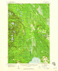
Shingleton serves as the primary hub of this landscape, situated at the junction of the Duluth South Shore and Atlantic and the Manistique and Lake Superior railroads. The topography is dominated by the sprawling wetlands of the Munising and Hiawatha areas, where a complex network of waterways like the North Branch Anderson Creek and Stutts Creek drain the low-lying timberlands.
Find a feature on this map
26 named features on this map. Tap any name to fly to it.
Don’t see what you’re looking for? This feature index may not catch every label — zoom into the map to look around manually.
Map Details
Editions of this 1931 Shingleton SW Map
This is the sole edition of this map. No revisions or reprints were ever made.
Other maps of this area

1931 · Steuben NE
USGS Topo · 1:31,680

1931 · Steuben NW
USGS Topo · 1:31,680

1931 · Shingleton NE
USGS Topo · 1:31,680

1931 · Skeels Lake NE
USGS Topo · 1:31,680

1931 · Shingleton SE
USGS Topo · 1:31,680

1931 · Munising SE
USGS Topo · 1:31,680

1958 · Corner Lake
USGS Topo · 1:62,500

1958 · Munising
USGS Topo · 1:62,500

1958 · Shingleton
USGS Topo · 1:62,500
1958 · Steuben
USGS Topo · 1:62,500